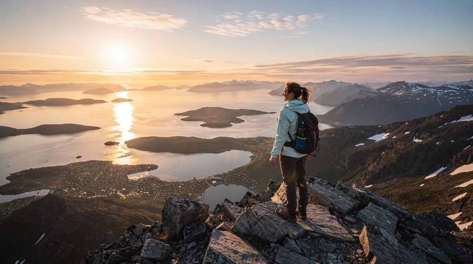
Tromsdalstinden hike — guide to Tromsø's highest accessible summit
Tromsø: Midnight Sun Hike in the Wilderness
How hard is the Tromsdalstinden hike?
Tromsdalstinden (1238 m) is a challenging full-day hike with 1100 m of elevation gain from the trailhead at Tromsøysund. Expect 5–7 hours return. The upper section involves steep, loose scree and requires good physical fitness plus proper footwear. Not suitable for beginners or young children.
Tromsdalstinden stands at 1238 m on the mainland directly opposite Tromsø city island. It is the dominant peak in the local skyline — the triangular white summit visible from the waterfront, from the Fjellheisen viewpoint, and from the Arctic Cathedral. Hiking it is the most serious mountain objective accessible from Tromsø without driving hours into the interior.
This guide covers the full route from trailhead to summit, realistic time estimates, conditions by season, gear requirements, and honest safety considerations.
| Where | Tromsdalen, mainland side of the Tromsø Bridge |
| Cost | Free (self-guided); around 2,500–4,000 NOK for a private guide, group of 2–4 |
| Time needed | 5–7 hours return |
| Getting there | Bus 37 (~10 min) or a 120–150 NOK taxi from central Tromsø |
| Best time | June–September, snow-free above 800 m |
The route: trailhead to summit
Trailhead: Tromsdalen, on the mainland side of the Tromsø Bridge. Bus 37 from the city centre takes roughly 10 minutes. By car, park near the Tromsdalen church or the sports grounds — do not block private driveways. The trail begins near the Tromsdalselva river.
Lower section (0–600 m elevation): The path climbs steeply through birch forest and over open moorland. It is initially well-worn, then becomes more diffuse above the treeline. This section takes 1.5–2.5 hours.
Upper section (600–1238 m): Above the plateau, the route heads directly up a loose scree ridge toward the summit block. This is the most demanding part — large, unstable boulders alternating with compacted scree. Trekking poles are valuable here for balance and to reduce knee load on the descent. The summit ridge has some exposure on the left (south) side — not technical, but a slip could be serious. This section takes 1–2 hours.
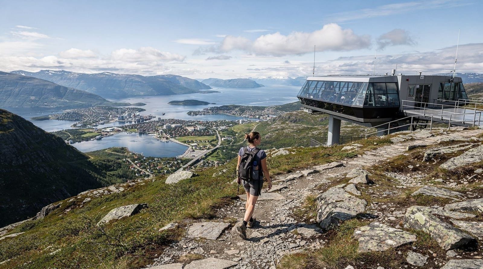
Summit (1238 m): The top is marked by a cairn. Views extend over Tromsøysund, Tromsøya island, Kvaløya to the west, and the Lyngen Alps to the south-east. On exceptionally clear days, the horizon extends 100 km or more.
Descent: Reverse the ascent route. Allow 2–3 hours. The loose scree section is harder going down than up — take your time and keep weight over your heels. Trekking poles are important.
Elevation and distance
- Summit: 1238 m above sea level
- Trailhead elevation: roughly 100–150 m
- Elevation gain: approximately 1100 m
- Distance return: 12–16 km depending on exact route variations
- Typical return time: 5–7 hours
Difficulty rating
Challenging. This is a mountain hike, not a trail hike. The terrain is loose and steep above the treeline, there is no waymarking above the forest, and the summit section has moderate exposure. Anyone who regularly hikes in Alpine terrain will find it manageable in summer conditions. First-time hikers, those without ankle-support boots, or anyone unfit should attempt Fjellheisen / Storsteinen first.
Seasonal conditions
June–September: The optimal window. Snow-free above 800 m by mid-June in a normal year. July and August are the driest months. In midnight sun season (May–July), you can complete the hike in continuous daylight — see our midnight sun hikes guide for timing tips.
October–November: Increasing snow on the upper section. The summit can be icy. Micro-spikes become essential. Daylight shortens rapidly — start early.
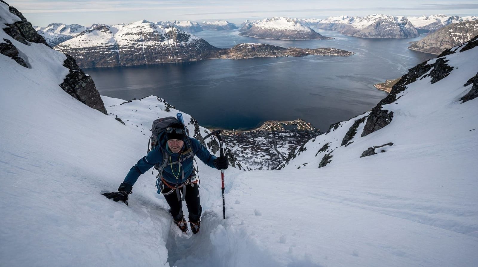
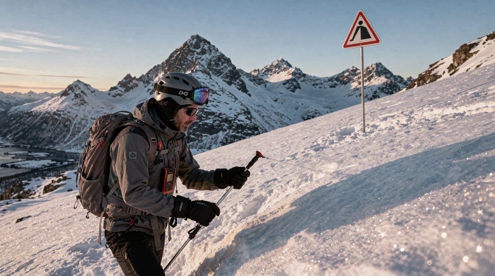
December–April: The route is a serious winter mountaineering objective. Avalanche risk on the upper slopes is real; the ridge above 900 m accumulates wind-slab. Do not attempt without proper winter mountaineering gear and knowledge of avalanche assessment. Read our hiking safety and avalanche guide before considering a winter ascent.
May: Snow consolidates and the route may be excellent for experienced ski tourers or those with crampons and ice axes. Late May can combine good snow conditions with midnight sun lighting.
Safety — honest assessment
Tromsdalstinden is not a beginner mountain. Every season, rescue operations are called out for poorly-prepared hikers — usually on the scree section, often due to inadequate footwear or underestimated descent time.
Key risks:
- Loose scree descent in tired legs: easy to fall
- Weather deterioration: storms move in fast from the west; temperature drops 6°C per 1000 m
- Avalanche risk October–May on the upper section
- No phone signal on parts of the route
Before you go:
- Check yr.no (Norwegian meteorological service) — not just for Tromsø city but for 1200 m elevation forecasts
- Tell someone your plan and expected return time
- Carry a paper map; GPS works but phone batteries drain faster in cold
- Know basic first aid for ankle sprains
- Bring a headtorch even in summer — delays happen
For a full breakdown of hazard assessment, see our avalanche and hiking safety guide for Tromsø.
Midnight sun hiking on Tromsdalstinden
One of the extraordinary experiences of the Arctic summer is climbing Tromsdalstinden during the midnight sun period (late May–late July). Starting a summit bid at 20:00 or 21:00 means arriving at the top between midnight and 02:00 with the sun still above the horizon. The light at this hour is warm and low-angled; the fjord below glows; there is no one else on the mountain.
This is only appropriate for experienced hikers with good navigation skills and no fear of exposure. The trail is not lit, and although daylight is continuous, the low sun can flatten terrain and make the scree ridge harder to read.
For guided midnight sun hiking in the mountains around Tromsø without the technical demands of Tromsdalstinden, a guided wilderness hike is the safer option.
What to eat and drink on the route
There are no facilities on the mountain. Bring at least 2 litres of water per person — there is a stream near the trailhead but water sources above the treeline are not reliable and should be treated or filtered if used. For food, calorie-dense snacks are more useful than a heavy lunch: nuts, chocolate, energy bars, a sandwich. Most people eat at the summit.
After the hike, Tromsdalen has no restaurants. Drive or bus back to Tromsø city centre, where budget eating options start from around 130 NOK.
Getting to the trailhead
Bus: Line 37 from Tromsø bus station, direction Tromsdalen, takes about 10 minutes. Check Troms og Finnmark Fylkeskommune app for current schedules.
Car: Cross the Tromsø Bridge, turn right toward Tromsdalen. Park at the sports grounds or near the church. Do not park on private land — residents of Tromsdalen have ongoing conflicts with hikers blocking driveways.
Taxi/rideshare: Around 120–150 NOK from the city centre one-way.
Guided mountain hikes in the Tromsø area
If you want to experience genuine Arctic mountain terrain without the planning burden, guided alpine-style hikes are available in the Lyngen Alps, which offer even more dramatic scenery. See our Lyngen day hikes guide for options.
Tromsdalstinden as a landscape feature
Part of Tromsdalstinden’s appeal as a hiking objective is its visibility. From the Tromsø waterfront, from the Arctic Cathedral (the triangular glass church on the mainland), from the Fjellheisen summit, and from the Tromsø Bridge — Tromsdalstinden is always there, a clear triangular pyramid 1238 m above the city.
This visibility creates a relationship between the city and the mountain that influences how Tromsø residents think about outdoor life. The mountain is a constant presence — you see it every morning from the ferry terminal, every evening from the harbour cafés. The question “have you done Tromsdalstinden?” is a standard local conversation among hikers, equivalent to Londoners asking about Box Hill or New Yorkers asking about the Breakneck Ridge.
Understanding this cultural weight helps contextualise the hike. It is not just a route to a summit — it is the local test piece, the mountain that separates people who genuinely engage with Tromsø’s outdoors from those who only take the cable car.
Weather patterns at Tromsdalstinden summit
The summit at 1238 m experiences weather that can be significantly different from the city below. On a 15°C sunny day in July at Tromsø waterfront, the summit temperature may be 4–8°C with a 20 kph wind — effectively 0°C wind chill. On a day with a 10 kph south wind below, the summit ridge can have 40–50 kph gusts.
Cloud cap formation: Tromsdalstinden frequently develops a cloud cap — a stationary cloud sitting on the summit while the valley below is clear. This is particularly common when south-westerly winds are present. A cloud-capped summit means zero visibility at the top, potential navigation difficulty on the unfamiliar descent, and the risk of becoming disoriented in whiteout conditions.
Before departure: look at the mountain from the city. If you can see the summit clearly, conditions are acceptable. If a cloud sits on the peak, consider whether your navigation skills and gear are adequate for those conditions.
Rain from the south: The Norwegian west coast brings fronts from the south-west. When a front arrives, Tromsdalstinden’s south-facing slope is exposed first — rain can set in quickly while weather forecasts for “Tromsø” still show dry conditions (because the city on the island is in the frontal rain shadow initially).
Alternative — hire a local guide for Tromsdalstinden
Several Tromsø outdoor guides offer guided ascents of Tromsdalstinden in summer. These are not typical tourist experiences — they are for hikers who want mountain guidance on a challenging route. A guide:
- Assesses conditions on the day and will cancel or reroute if the summit is in cloud
- Knows the safest descent line on the loose scree
- Has emergency first aid training and communication equipment
- Carries group shelter and basic bivouac equipment
Cost for a private guided Tromsdalstinden ascent: typically 2500–4000 NOK for a group of 2–4 people. Ask local outdoor guiding companies in Tromsø for current availability.
Physical preparation
If you are not a regular hiker, prepare for Tromsdalstinden by building up to it. The Fjellheisen Sherpa trail (420 m elevation gain) is the logical first step — complete that comfortably before committing to Tromsdalstinden. Then consider a hike in the Lyngen Alps or Senja hills (600–800 m gain) before attempting the full 1100 m.
On the day: eat a proper breakfast before the hike (you will burn through 1500–2500 calories over the return trip), and begin well-hydrated. Dehydration at altitude reduces judgment and physical performance.
Timing: Most Tromsdalstinden incidents occur on the descent, in the late afternoon, in tired legs. Build in the assumption that your descent will take as long as your ascent. Do not rush on the scree.
What fitness level do you actually need
“Good physical fitness” is vague, so here is a more concrete benchmark: if you can comfortably run or briskly hike for 90 minutes continuously, or regularly climb 5+ flights of stairs without stopping, you have a reasonable baseline. If your longest recent hike is under 2 hours or under 400 m of elevation gain, treat Tromsdalstinden as a stretch goal rather than a default choice — build up to it across a trip or a season rather than attempting it cold on day one. Leg strength for the descent matters as much as cardio for the ascent; quad and knee fatigue on the scree is the most common reason hikers slow dramatically in the final hour.
How Tromsdalstinden compares to other Tromsø hikes
If you are weighing Tromsdalstinden against other options, it sits at the top of the local difficulty scale. Fjellheisen and the Storsteinen hike (420 m gain) is the accessible warm-up most locals recommend first, and the best midnight sun hikes guide rounds up gentler alternatives if a full mountain day is not what you are after. For a broader view of what “hiking in Tromsø” covers beyond this one summit, see the snowshoeing Tromsø guide for the winter equivalent when Tromsdalstinden itself is off-limits.
Combining the hike with a longer Tromsø stay
Tromsdalstinden works best as a single full-day commitment rather than one activity among several in a busy day. If you are planning a 3-day winter or 5-days winter itinerary, this hike does not fit — save it for a summer return. For a summer trip, the 3-days midnight sun itinerary can accommodate it as the anchor day, ideally with a rest day either side given the 1100 m of gain.
Honest verdict
Frequently asked questions about the Tromsdalstinden hike
Where is the trailhead for Tromsdalstinden?
The standard trailhead is at Tromsdalen on the mainland — take bus 37 from Tromsø city centre (10 minutes) or drive across the Tromsø Bridge. Park near the Tromsdalen church area.
How long does the Tromsdalstinden hike take?
Most fit hikers complete the return trip in 5–7 hours: 3–4 hours up, 2–3 hours down. Allow extra time if conditions are wet, icy, or if you stop frequently.
Do I need a guide for Tromsdalstinden?
No permit or guide is required, but the upper section is steep, loose, and unwamarked. You should have experience on similar terrain and be able to assess conditions independently.
Is Tromsdalstinden accessible year-round?
The summit is safest June–September. October–May, avalanche risk and icy terrain raise the difficulty significantly. Winter ascents require mountaineering equipment and experience.
What gear do I need?
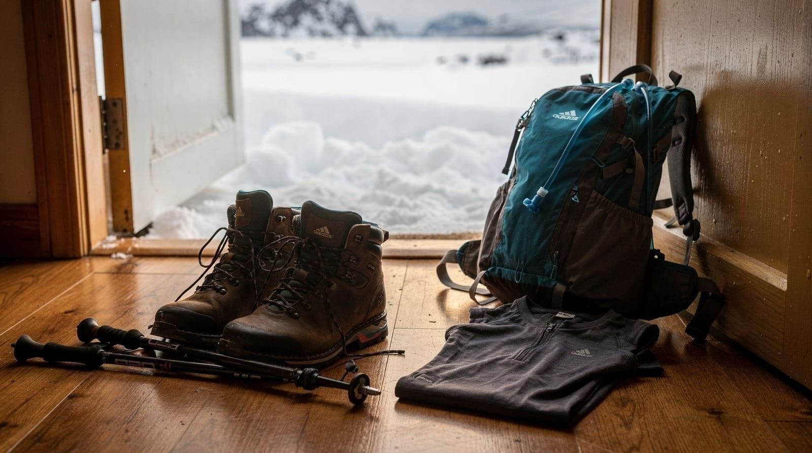
Solid hiking boots with ankle support, trekking poles, 2+ litres of water, wind/waterproof jacket, snacks, and a map. October–May: micro-spikes or crampons. Full list at our hiking gear guide.
How high is Tromsdalstinden?
1238 m above sea level — the highest peak visible from central Tromsø and one of the most prominent summits in the Tromsøysund area.
Can I see the mountain from Tromsø city?
Yes — Tromsdalstinden is the clear triangular peak visible on the mainland from the waterfront, the Tromsø Bridge, and from the Fjellheisen cable car summit at Storsteinen.
Should I hike Tromsdalstinden before or after Fjellheisen?
Before, in the sense of training — do Fjellheisen/Storsteinen first to gauge your fitness and comfort on Tromsø terrain, then attempt Tromsdalstinden on a later day. Attempting both on the same trip in reverse order risks arriving at the harder hike already fatigued.
Is Tromsdalstinden a good midnight sun hike for photography?
Yes, for experienced hikers only — starting at 20:00–21:00 in late June or July puts you on the summit with the sun still up and low, warm light over the fjord. It is not a beginner photography outing given the terrain; see the midnight sun photography guide for camera settings suited to the low-angle light.
Top experiences
Bookable activities with verified prices and instant confirmation on GetYourGuide.